Topografía LiDAR profesionalProfessional LiDAR surveying

El terreno, medido punto por punto.The terrain, measured point by point.

Levantamientos LiDAR, volumetrías auditables y monitoreo mensual para operaciones industriales en todo México.LiDAR surveys, audit-ready volumetrics and monthly monitoring for industrial operations across Mexico.

MONTERREY, MX · 25.6866 N, 100.3161 W · RESPUESTA EL MISMO DÍASAME-DAY RESPONSE

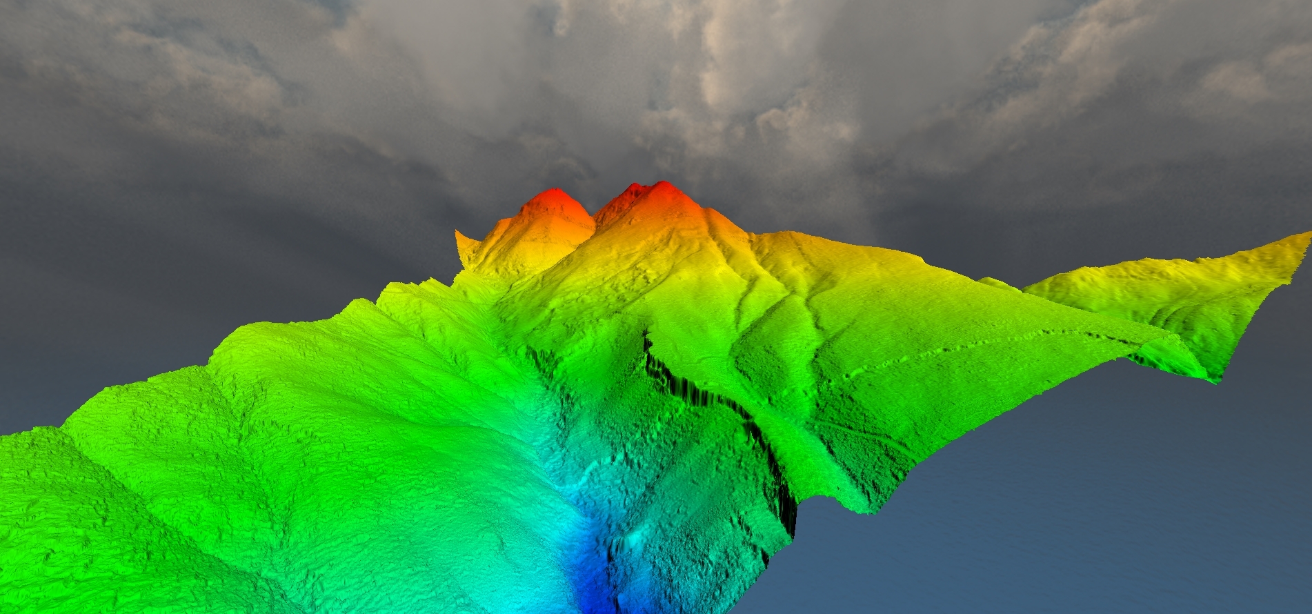
NUBE DE PUNTOS · DEM REALPOINT CLOUD · REAL DEM
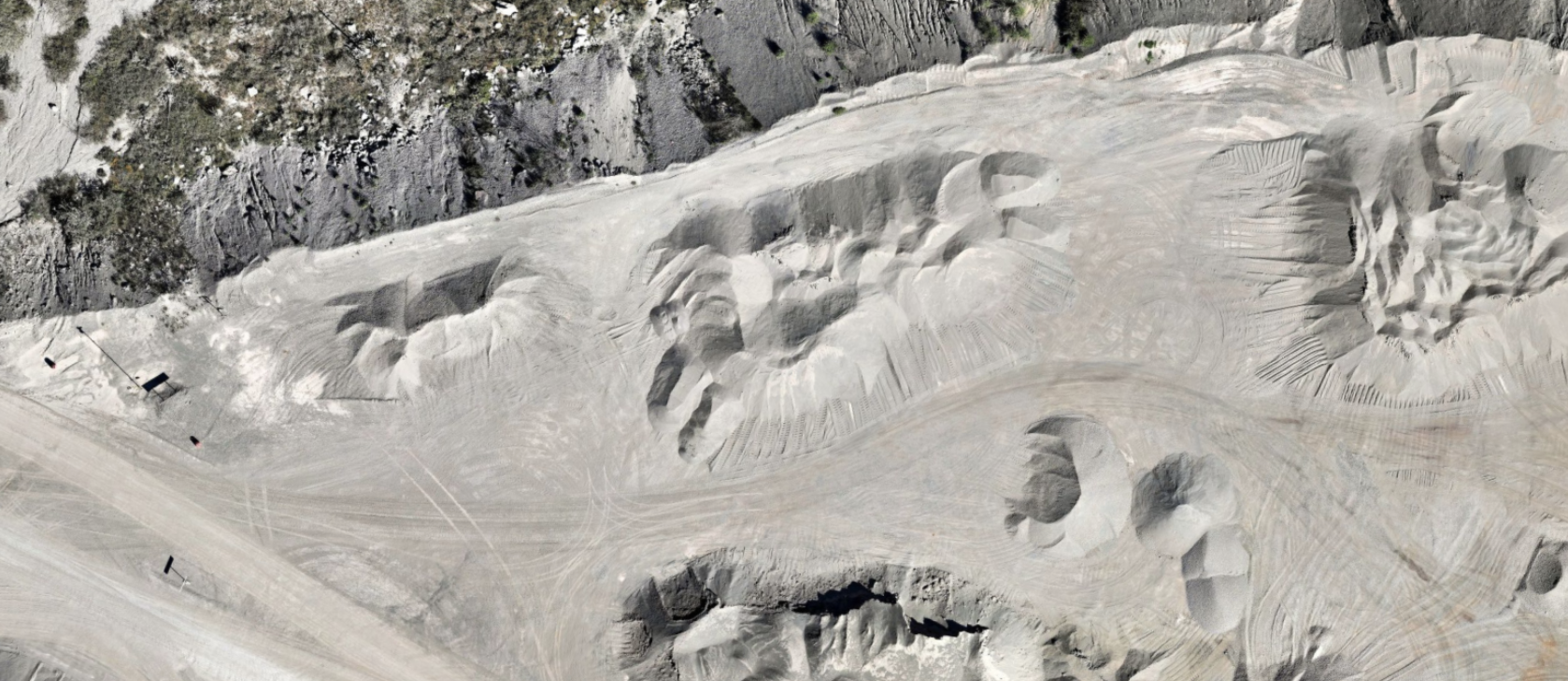
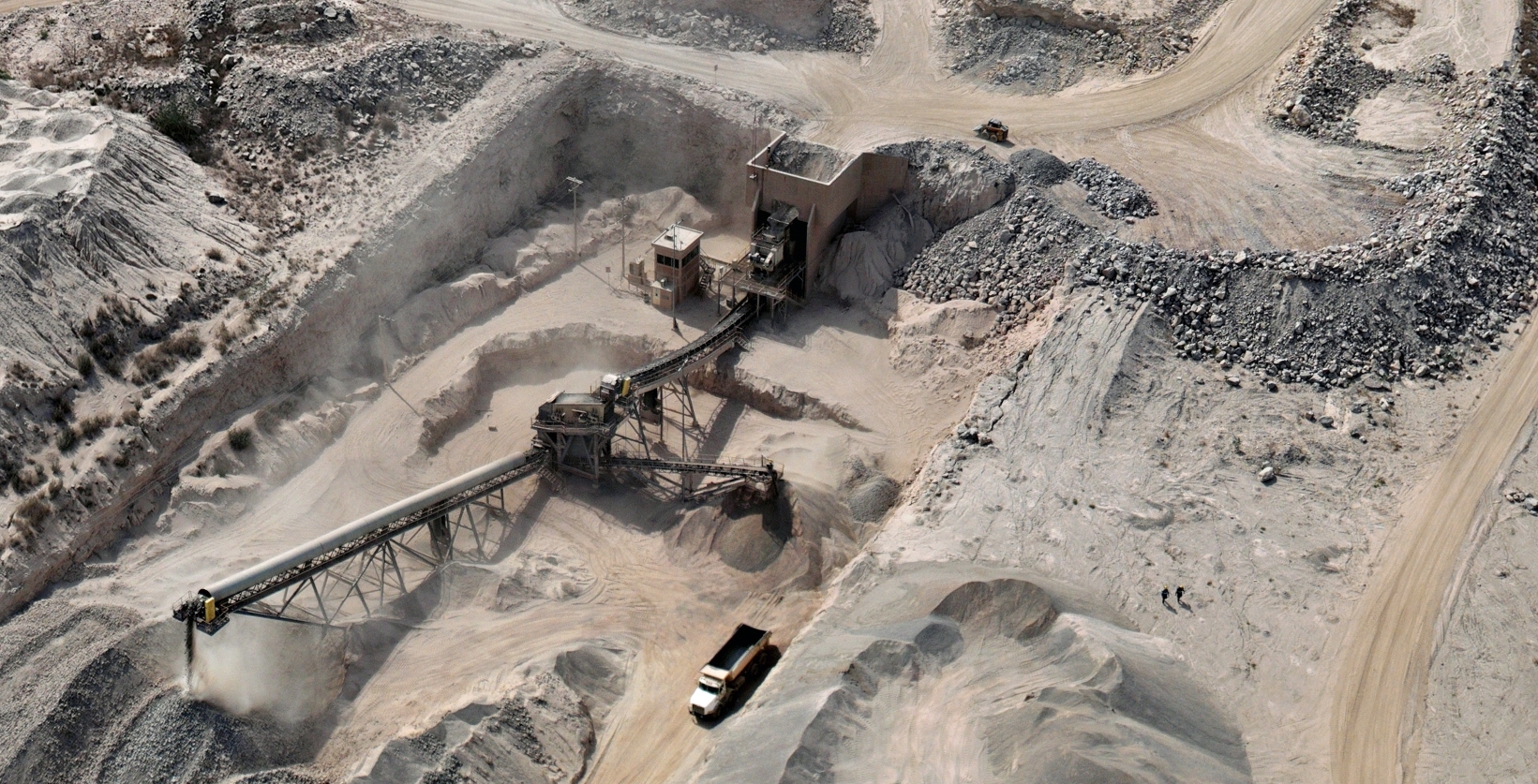
Cantera con planta de trituración, vista aérea
25.632 N · 100.235 W · RES 10 CM/PX ARRASTRA PARA ORBITARDRAG TO ORBIT

LIDAR: NUBE DE PUNTOS SOBRE DEM REAL · RGB: CANTERA EN OPERACIÓNLIDAR: POINT CLOUD OVER A REAL DEM · RGB: QUARRY IN OPERATION

24+CLIENTES EN 9 SECTORESCLIENTS ACROSS 9 SECTORS
200 haPOR DRON, POR DÍA*PER DRONE, PER DAY*
50-400+PUNTOS/M² BAJO VEGETACIÓNGROUND PTS/M² UNDER CANOPY
2-3 sem2-3 wkDEL VUELO A ENTREGA COMPLETAFROM FLIGHT TO FULL DELIVERY
*TASA COMPROMETIDA; REGISTRADAS 400-500 HA/DÍA · DESDE 2022 · MÉXICO + EE.UU. · 15 PERSONASCOMMITTED RATE; 400-500 HA/DAY ON RECORD · SINCE 2022 · MEXICO + US · 15 PEOPLE REGISTROLOG · 0 VUELOSFLIGHTS · 0 KM · 0 H · 0 AERONAVES Y SENSORESAIRCRAFT AND SENSORS

SVC · SERVICIOSSERVICES

VERA cuenta lo que tienes. ATLAS mide tu territorio. CAPTA replica lo que construiste.VERA counts what you have. ATLAS measures your territory. CAPTA replicates what you built.

Tres servicios productizados, una sola cadena de calidad: control en campo, procesamiento propio en Monterrey y entregables que soportan auditoría.Three productized services, one quality chain: field control, in-house processing in Monterrey and deliverables that stand up to audit.

VERASVC 01

VOLUMETRIC EVALUATION AND RESERVE ASSESSMENT

Volumetría recurrente de acopios y reservasRecurring volumetrics of stockpiles and reserves

Cadencia mensual fija para canteras, minas, cemento y agregados: cualquier operación que concilia volúmenes extraídos o almacenados.Fixed monthly cadence for quarries, mines, cement and aggregates: any operation reconciling extracted or stored volumes.

Necesitas VERA si los volúmenes mueven dinero en tu operación y todavía los estimas.You need VERA if volumes drive money in your operation and you are still estimating them.

5 operadores minerosmining operators13-17 canteras activasactive quarries
  • Instalamos control terrestre y programamos planes de vuelo automatizadosWe install ground control and program automated flight plans
  • Entrenamos a tus propios operadores para volar en calendarioWe train your own operators to fly on schedule
  • Procesamos y controlamos la calidad de cada datasetWe process and quality-control every dataset
  • Programas recurrentes similares operan en gestión de residuosSimilar recurring programs run in waste management
Ver detalleDetails →
ATLASSVC 02

AERIAL TOPOGRAPHIC LIDAR AT SCALE

Topografía del terreno real, a gran escalaTopography of the real terrain, at scale

LiDAR de gran extensión que ve el terreno incluso bajo vegetación: infraestructura, energía, hidrología y desarrollo de tierra, a cientos o miles de hectáreas.Wide-area LiDAR that sees the terrain even under vegetation: infrastructure, energy, hydrology and land development, at hundreds or thousands of hectares.

Necesitas ATLAS si las decisiones dependen del terreno real, no del que un mapa supone.You need ATLAS if decisions depend on the real terrain rather than what a map assumes.

50-400+ pts/m²10 cm resolución defaultdefault resolution
  • Nubes de puntos clasificadas; MDT a 10 cm, 50 cm para vegetación escasa y terreno suaveClassified point clouds; DTM at 10 cm, 50 cm for sparse vegetation and gentle terrain
  • Ortofotos, curvas de nivel, perfiles y superficies listas para hidrologíaOrthophotos, contours, profiles and hydrology-ready surfaces
  • 1,700 ha voladas en 4 días; corredores de ~200 km; 2,500 ha en una semana1,700 ha flown in 4 days; ~200 km corridors; 2,500 ha in one week
Ver detalleDetails →
CAPTASVC 03

CAPTURE OF AS-BUILT PRECISION AND TRIDIMENSIONAL ASSETS

Lo construido, capturado exactamenteWhat is built, captured exactly

Captura 3D de alta precisión de estructuras y activos: plantas, edificios, túneles, infraestructura y patrimonio, por dentro y por fuera.High-precision 3D capture of structures and assets: plants, buildings, tunnels, infrastructure and heritage, inside and out.

Necesitas CAPTA si debes saber exactamente qué está construido, por dentro y por fuera.You need CAPTA if you must know exactly what is built, inside and out.

CAD/BIM listosreadyVisor webWeb viewer
  • Nubes densas de interiores y exteriores, incluyendo lo que las plataformas aéreas no venDense clouds of interiors and exteriors, including what aerial platforms cannot see
  • Gemelos digitales fotorealistas, planos CAD y modelos listos para BIMPhotorealistic digital twins, CAD plans and BIM-ready models
  • Visores web: todo tu equipo recorre el activo desde el navegadorWeb viewers: your whole team walks the asset from a browser
  • Operamos los mismos escáneres Lixel y PortalCam que vendemos: demo sin costo y soporte localWe operate the same Lixel and PortalCam scanners we sell: free demo and local support
Ver detalleDetails →

XGRIDS · DISTRIBUIDOR OFICIAL MXXGRIDS · OFFICIAL DISTRIBUTOR MX

VER LOS TRES SERVICIOS A FONDO →SEE ALL THREE SERVICES IN DEPTH →

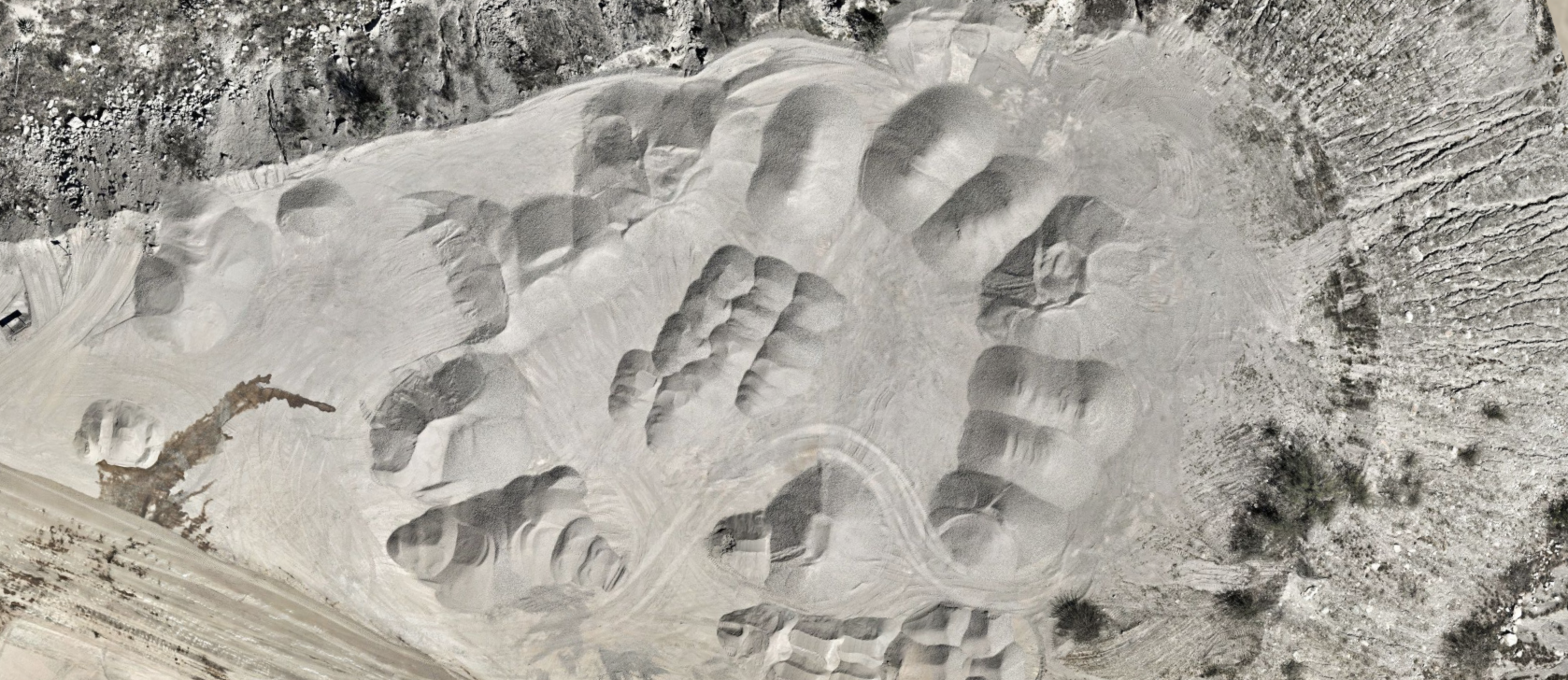
Acopios, campaña octubre 2025 Acopios, campaña febrero 2025 FEB 2025OCT 2025
DOS CAMPAÑAS REALES DEL MISMO PATIO DE ACOPIOS · CIFRAS DE VOLUMEN ILUSTRATIVASTWO REAL CAMPAIGNS OF THE SAME STOCKPILE YARD · VOLUME FIGURES ILLUSTRATIVE

VERA · EN LA PRÁCTICAIN PRACTICE

Cambios reales, medidos entre campañas.Real change, measured between campaigns.

Arrastra el comparador: dos vuelos del mismo sitio, y el material que se movió entre ellos. Así se ve un reporte que soporta auditoría.Drag the comparator: two flights of the same site, and the material moved between them. This is what an audit-ready report looks like.

CORTECUT-42,180 m³
RELLENOFILL+12,440 m³
NETO / NET-29,740 m³
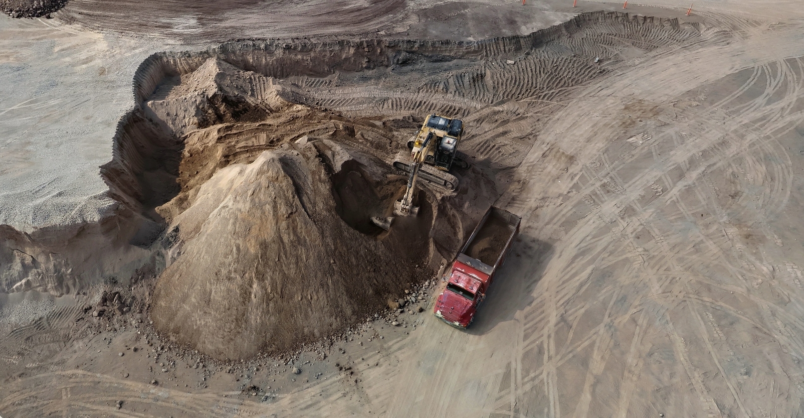
Excavadora cargando camión desde un acopio, vista aérea
LO QUE VERA MIDE · ACOPIO EN CARGAWHAT VERA MEASURES · STOCKPILE BEING LOADED

EVIDENCIA DE MÉTODOMETHOD EVIDENCE

Medimos bajo la vegetación. Y lo probamos.We measure beneath the vegetation. And we prove it.

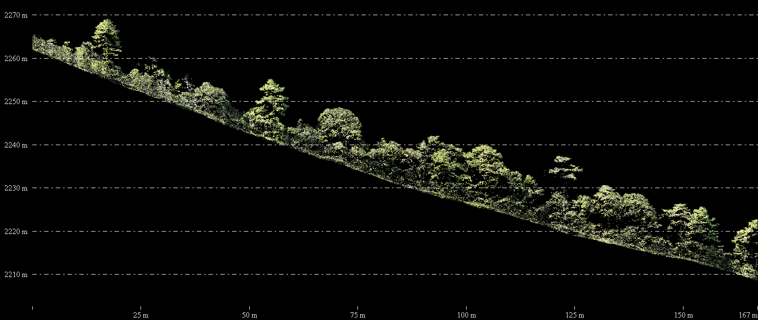
Un corte transversal de nube real: el dosel arriba, el suelo clasificado abajo, la elevación en metros. Esto es ATLAS a 50-400+ puntos de suelo por metro cuadrado.A cross-section of a real cloud: canopy above, classified ground below, elevation in meters. This is ATLAS at 50-400+ ground points per square meter.

Corte transversal de nube de puntos: vegetación arriba, suelo clasificado abajo
CORTE TRANSVERSAL REAL · DOSEL / SUELO CLASIFICADO · EJE DE ELEVACIÓN EN METROSREAL CROSS-SECTION · CANOPY / CLASSIFIED GROUND · ELEVATION AXIS IN METERS

RESOLUCIÓN: 10 CM POR DEFECTORESOLUTION: 10 CM DEFAULT

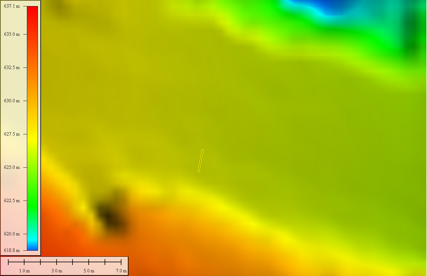
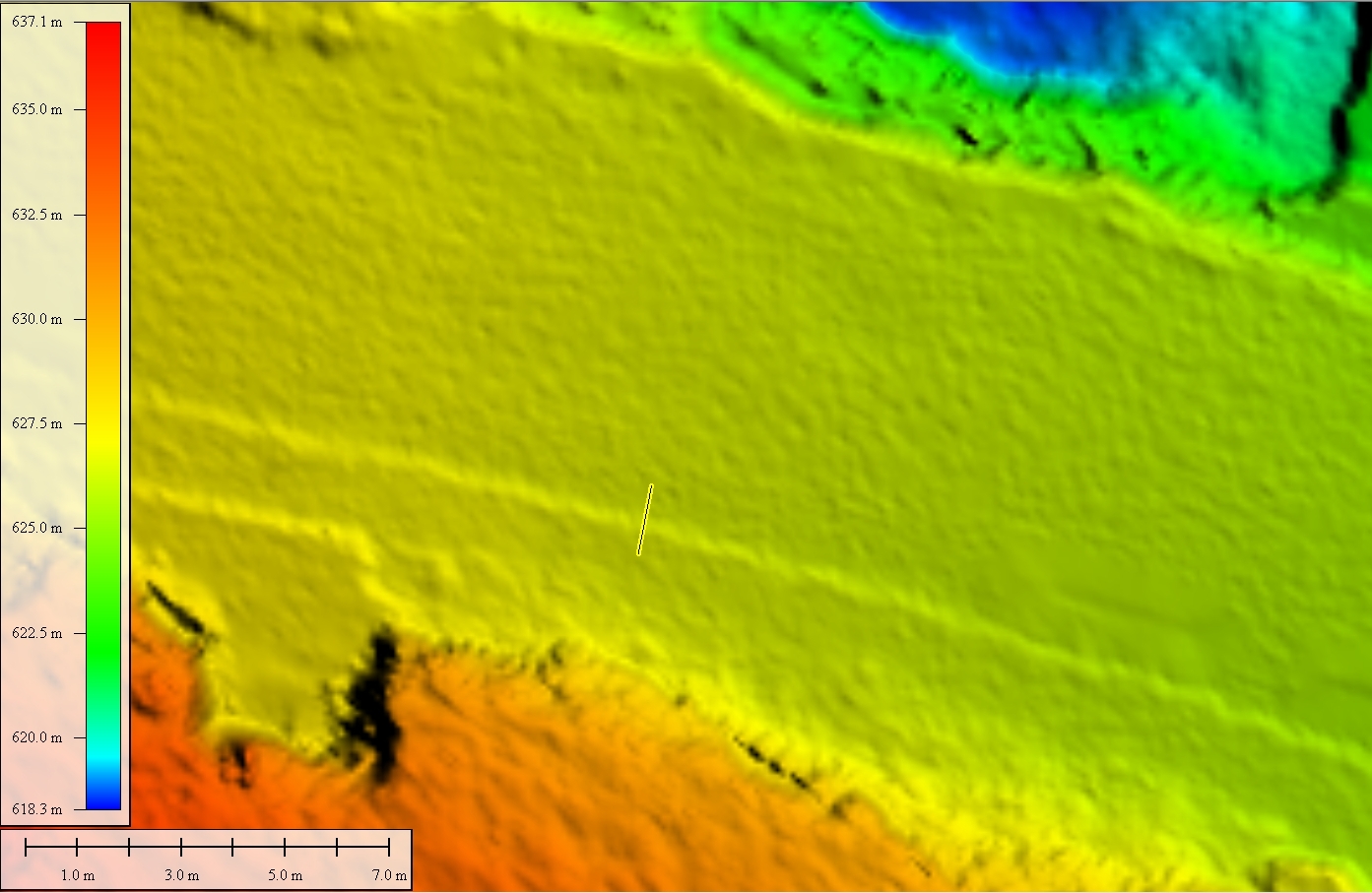
Mismo terreno, misma leyenda, misma escala. Arrastra: 50 cm se reserva para vegetación escasa y terreno suave; 10 cm es el estándar de entrega. La línea marcada en el círculo es el transecto que se grafica en el perfil de abajo.Same terrain, same legend, same scale. Drag: 50 cm is reserved for sparse vegetation and gentle terrain; 10 cm is the delivery standard. The line inside the circle is the transect plotted in the profile below.

Perfil del mismo transecto a 10 cm y 50 cm
EL TRANSECTO MARCADO, EN PERFIL · LA LÍNEA DE 50 CM (ROJA) FLOTA SOBRE EL MICRORRELIEVE QUE LA DE 10 CM SÍ REGISTRATHE MARKED TRANSECT, IN PROFILE · THE 50 CM LINE (RED) FLOATS OVER MICRO-RELIEF THE 10 CM LINE CAPTURES
MDT a 50 cm de resolución MDT a 10 cm de resolución 10 CM50 CM
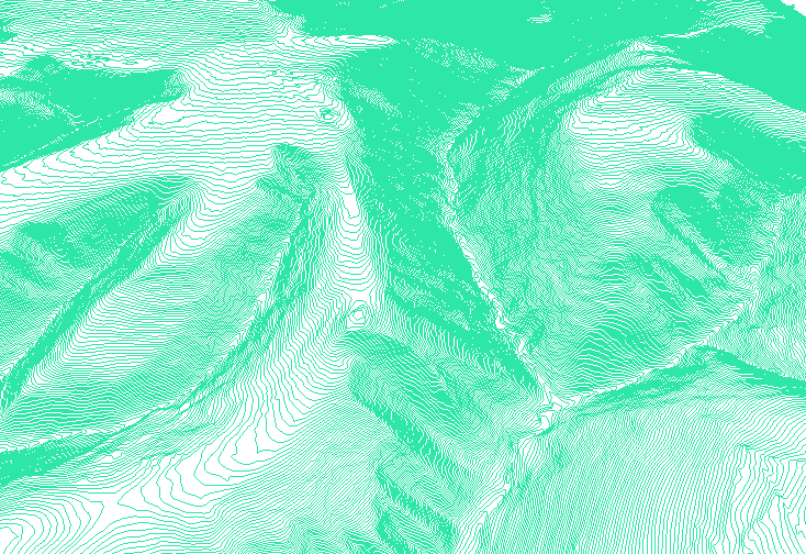
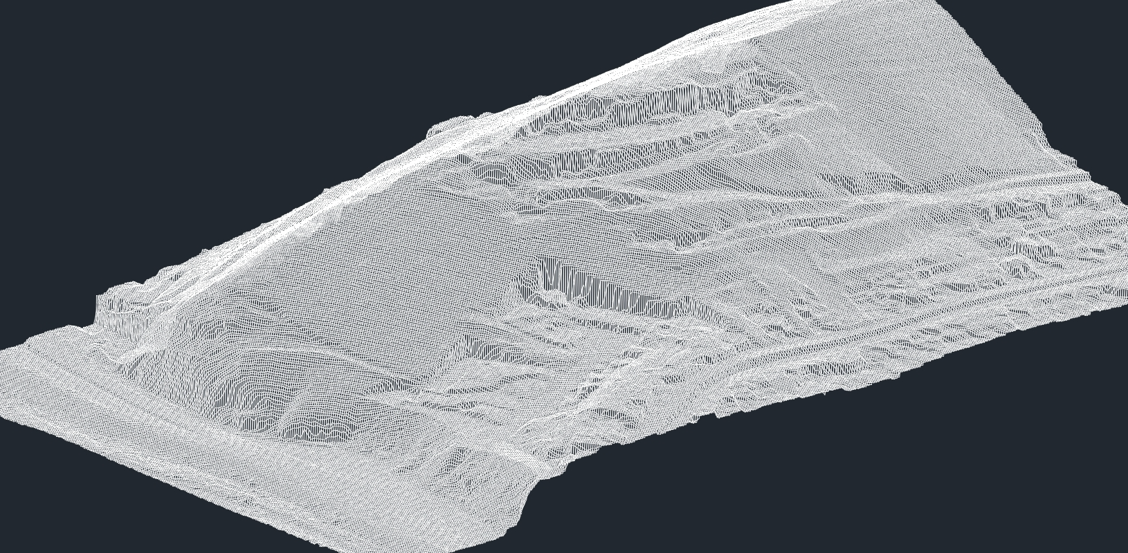
Malla TIN de superficie en wireframe
MALLA TIN DE SUPERFICIE · LISTA PARA TU FLUJO CADTIN SURFACE MESH · READY FOR YOUR CAD WORKFLOW
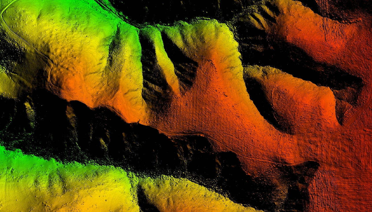
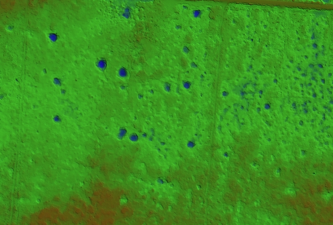
Modelo digital de terreno coloreado por elevación
MDT DE ALTO DETALLE · 10 CM POR DEFECTOHIGH-DETAIL DTM · 10 CM DEFAULT

CÓMO TRABAJAMOSHOW WE WORK

Un ciclo, tres pasos, cero fricción.One cycle, three steps, zero friction.

PASO 01 · CAMPOFIELD

Vuelo y capturaFlight and capture

Control terrestre en campo y planes de vuelo automatizados. 200 hectáreas por dron por día, comprometidas; 400-500 registradas.Ground control in the field and automated flight plans. 200 hectares per drone per day, committed; 400-500 on record.

PASO 02 · MONTERREY

Procesamiento propioIn-house processing

Cada dataset se procesa, clasifica y controla por nuestro propio equipo en Monterrey. Nada se subcontrata.Every dataset is processed, classified and quality-controlled by our own team in Monterrey. Nothing is outsourced.

PASO 03 · ENTREGADELIVERY

Completa en 2-3 semanasComplete in 2-3 weeks

Del último vuelo a la entrega total: reporte ejecutivo, archivos en tus formatos y tablero actualizado.From the final flight to full delivery: executive report, files in your formats and an updated dashboard.

CASOS DE ÉXITOCASE STUDIES

Resultados medidos, no prometidos.Results measured, not promised.

Malla de terreno del corredor Interserrana
GOBIERNO DEL ESTADO DE NUEVO LEÓN · CARRETERA INTERSERRANAINTERSERRANA HIGHWAY

Cerramos el dataset que otro proveedor no pudo.We closed a dataset another provider could not.

Terreno tan remoto que la captura convencional era impráctica, y datos de un tercero que no cuadraban entre sí. Producimos topografía satelital para los tramos remotos; diagnosticamos, corregimos e integramos los datos existentes en un levantamiento consistente. El proyecto avanzó sobre un solo dataset coherente, sin re-volar el corredor.Terrain too remote for conventional capture, and third-party data that did not hold together. We produced satellite-derived topography for the remote sections, then diagnosed, corrected and integrated the existing data into one consistent survey. The project moved forward on a single coherent dataset, without re-flying the corridor.

1 DATASET COHERENTECOHERENT DATASET · 0 RE-VUELOSRE-FLIGHTS

SERVICIOS DE AGUA Y DRENAJE DE MONTERREY

100+ fugas detectadas en 100+ km de acueducto100+ leaks detected along 100+ km of aqueduct

Inspección aérea multiespectral e infrarroja de corredores demasiado largos para recorrer a pie, mapeada para reparación.Aerial multispectral and infrared inspection of corridors too long to walk, mapped for repair.

MULTIESPECTRAL + IR

FIDEPROES · LIBRAMIENTO PESQUERÍA-JUÁREZPESQUERÍA-JUÁREZ BYPASS

El terreno que habilitó optimizar las terraceríasThe terrain that made earthworks optimization possible

Topografía del corredor y monitoreo recurrente de construcción: una optimización que no se habría corrido sin terreno LiDAR preciso, y un registro continuo del avance por dos años.Corridor topography and recurring construction monitoring: an optimization that would not have been run without precise LiDAR terrain, and a continuous two-year record of progress.

24 MESES DE MONITOREOMONTHS OF MONITORING

Relieve sombreado con parteaguas y depresiones
SECTOR HÍDRICO · CLIENTE CONFIDENCIALWATER SECTOR · CONFIDENTIAL CLIENT

1,700 hectáreas voladas en 4 días1,700 hectares flown in 4 days

Estudio hidrológico de gran escala, con entrega completa dentro de un mes.Large-scale hydrological study, fully delivered within one month.

ENTREGA EN 1 MESDELIVERED IN 1 MONTH

CONFÍAN EN NOSOTROSTRUSTED BY

Servicios de Agua y Drenaje de Monterrey FIDEPROES Gobierno del Estado de Nuevo León CFE Axtel Tecnológico de Monterrey

CREDENCIALESCREDENTIALS

Listos para tu área de compras.Ready for your procurement team.

REPSE

Registro vigente: el filtro de contratación que las áreas de compras corporativas en México aplican primero.Active registration: the procurement filter corporate buyers in Mexico apply first.

  • Pilotos licenciados y todos los permisos para operación comercial de drones en MéxicoLicensed pilots and every license required for commercial drone operation in Mexico
  • Todo el equipo aseguradoAll equipment insured
  • Proveedor registrado en 10 padrones corporativos y de gobiernoRegistered supplier in 10 corporate and government procurement registries

CERTIFICACIONES DEL EQUIPOTEAM CERTIFICATIONS

FAA PART 107PHOENIX LIDAR FLIGHT READINESSLEICA LSCMATTERPORT MSPPEPLINK PMCELIDAR USAARCSKY

Cada dataset se procesa, clasifica y controla en Monterrey, por nuestro propio equipo. Nada se subcontrata.Every dataset is processed, classified and quality-controlled in Monterrey, by our own team. Nothing is outsourced.

CUÁNDO NO CONTRATARNOSWHEN NOT TO HIRE US

La estación total sigue siendo la opción correcta para sitios pequeños con líneas de vista claras, y la fotogrametría sola suele bastar donde la vegetación es escasa. Lo decimos cuando es el caso.A total station is still the right choice for small sites with clear lines of sight, and photogrammetry alone is often enough where vegetation is sparse. We say so when that is the case.

Nuestros servicios existen donde esos métodos dejan de alcanzar: grandes extensiones, vegetación densa, medición recurrente, y lugares donde nadie debería tener que caminar.Our services exist for where those methods stop being enough: large areas, dense vegetation, recurring measurement, and places people should not have to walk.

PLATAFORMA · SOFTWARE PROPIOPLATFORM · IN-HOUSE SOFTWARE

Cuatro de cada diez personas en Visio escriben software.Four of every ten people at Visio write software.

Quince personas, seis desarrolladores, a propósito. La captura es el primer paso: el procesamiento, la clasificación, el control de calidad y la entrega son donde competimos. Tus datos llegan a un portal vivo, multi-sitio y exportable.Fifteen people, six developers, on purpose. Capture is the first step: processing, classification, quality control and delivery are where we compete. Your data lands in a living portal, multi-site and exportable.

CAPTURA DEL PORTAL VISIO · PENDIENTEVISIO PORTAL CAPTURE · PENDING
PORTAL VISIO · REPORTE EN VIVO, EXPORTABLE A EXCEL Y PDFVISIO PORTAL · LIVE REPORTING, EXPORTABLE TO EXCEL AND PDF

EMPECEMOSLET'S START

Cuéntanos qué necesitas medir.Tell us what you need measured.

Respondemos el mismo día, con un enfoque claro y un precio por hectárea.We reply the same day, with a clear approach and a price per hectare.

info@visio.mx · MX +52 81 2895 6414 · US +1 970 306 9068
MONTERREY, N.L. · OPERAMOS EN TODO MÉXICO Y EE.UU.OPERATING ACROSS MEXICO AND THE US